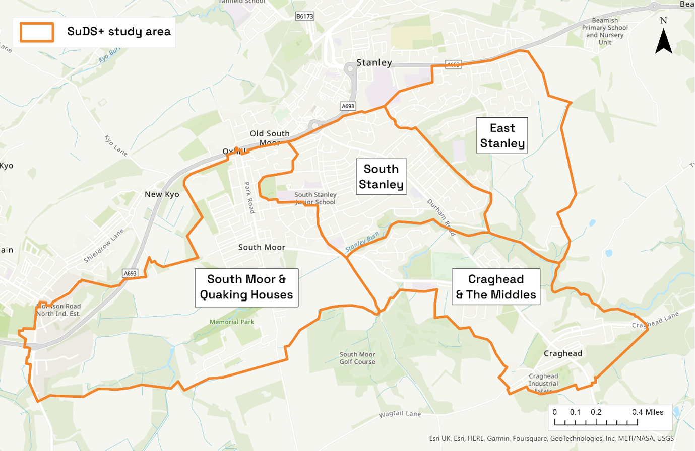

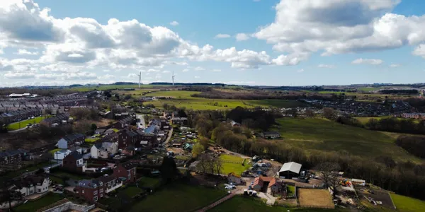

The project area is located in the upper catchment of the Twizell Burn, a tributary of the River Wear. It covers the source of the Stanley Burn near Annfield Plain and follows it as it flows through the outskirts of the town of Stanley becoming the Twizell Burn further downstream. The study area is approximately 7 km2 covering urban and semi-rural areas to the south of Stanley. We refer to the study area as “Stanley South”.
For the purposes of this project, the study area has been broken down into four sub-areas, chosen to represent hydrological catchments, as well as distinct urban areas. Sub-areas also represent smaller yet distinctive places where people live and work. Stanley South mostly consists of the two Durham County Council electoral divisions Stanley and Craghead and South Moor. The whole area also falls under Stanley Town Council.
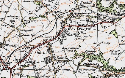
Stanley was a town built on coal mining and was transformed between 1800 and 1850 from a few farms and sparse settlements to a bustling industrial centre. The villages of Craghead, South Moor, and East Stanley were at the centre of the early coal industry. Homes were needed for an influx of miners and their families. The area quickly went from isolated rural hamlets to bustling villages with the shops, churches, schools and hotels to satisfy the needs of the population.
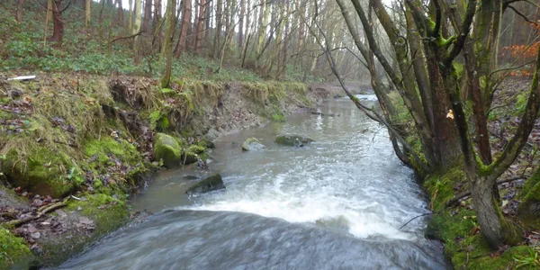
Every inch of the Twizell Burn has been modified for use in industry and the river suffers from pollution problems as a result of contamination from roads, mine waste and other human activity.
South Moor and Quaking Houses are historical mining communities, predominantly characterised by back-to-back terraced housing with little interspersed green space. The name, South Moor, comes from the area which was known as the south moor of Beamish which stretched from Beamish almost to Annfield Plain and at one time was classed as wasteland. However, with the discovery of coal this changed and, just as in other parts, the area developed rapidly with the expansion of coal mining.
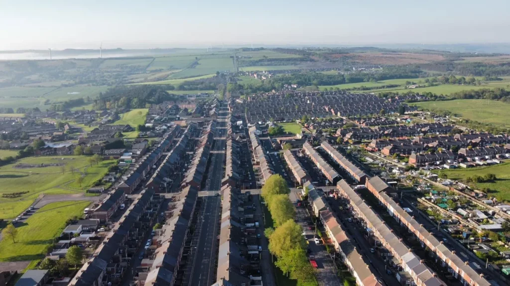
South and East Stanley are characterised by smaller areas of historical properties, instead mainly constituting post-war, semi-detached, former council properties. These developments feature large areas of open green-space, typically laid to grass.
The smaller settlements of The Middles and Craghead are similar to Quaking Houses in character, although both feature post-war estates, and both are now being extended further with new estates, such as Cloverhill Court and Middles Farm.
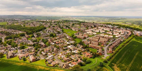
The study area more widely has significant areas of open green-space and woodland. These are distributed across the study area, particularly in the upper reach and along the course of the Twizell Burn. The Burn itself flows from west to east. It is a heavily modified watercourse, with several lengthy sections of culverting, and other man-made structures. The residential housing in these areas are mixed ownership, predominantly made up of housing associations and private tenanted houses, and are typical of the types of housing found across the northeast.
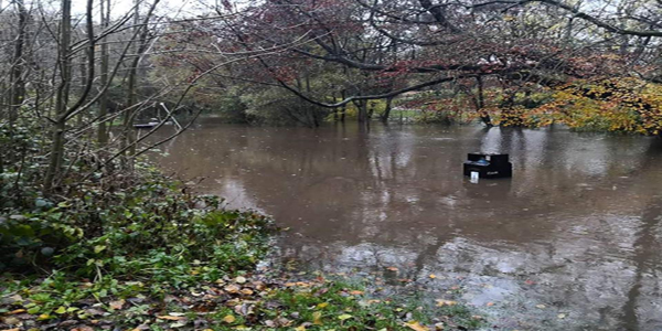
Previous flood studies and local knowledge have demonstrated that parts of the Stanley South area are at risk of flooding. Noticeable past events include 28th June 2012, winter 2015, and 5th November 2019, when flood water entered properties, schools closed, and roads were inundated. Locals also suspect poor water quality in the Twizell Burn due to road runoff, litter, mining pollution, and various contaminated outfalls. Take a look at our Knowledge Hub to find out more.
“I like the Stanley community. Everyone helps each other out”
“People are friendly. It’s a good place to live”
“Stanley has some beautiful views and lots of wildlife”
“Nothing for young people to do”
“Keep facilities going like The Venue. Keep investing in it.”
“Create more beautiful spaces for the community”